Shrews in Alaska
9 species of shrews have ten or more open-licence records in three or more years in Alaska. Open-licence records in the state that carry a month (8,132 of them) peak in August and are fewest in December.
The most often recorded is the Cinereus Shrew, with 4,156 open-licence records in the state.
The list rests on 9,056 open-licence records of shrews in the state; 6 further species have records there but fewer than ten, or in fewer than three years.
| Species | Open records | Years | Peak month | |
|---|---|---|---|---|
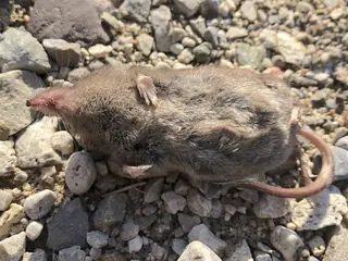 | Cinereus Shrew Sorex cinereus Soricidae | 4,156 | 23 | August |
| Dusky Shrew Sorex monticolus Soricidae | 2,730 | 22 | July | |
| Tundra Shrew Sorex tundrensis Soricidae | 504 | 14 | August | |
| Pribilof Island Shrew Sorex pribilofensis Soricidae | 278 | 6 | September | |
| Grizzled Small-Eared Shrew Cryptotis obscura Soricidae | 269 | 5 | July | |
| Barren Ground Shrew Sorex ugyunak Soricidae | 189 | 11 | August | |
| American Pygmy Shrew Sorex hoyi Soricidae | 155 | 8 | August | |
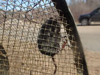 | American Water Shrew Sorex palustris Soricidae | 22 | 3 | |
| Miniscule Shrew Sorex minutissimus Soricidae | 20 | 4 |
A species is listed with ten or more open-licence records in Alaska across three or more years since 2000. Records are observations and specimens under CC0 and CC BY licences; they follow observers as well as animals, so a species that is missing is not shown to be absent.
More Alaska lists
Other groups in Alaska
Sources
- COMBINE: a coalesced mammal database of intrinsic and extrinsic traits. CC BY 4.0. Read 2026-11-15.
- EltonTraits 1.0. CC0. Read 2026-11-15.
- GBIF Backbone Taxonomy. CC BY 4.0. Read 2026-11-15.
- GBIF occurrence records under CC0 and CC BY 4.0. CC0 and CC BY 4.0 per record. Read 2026-11-16.
- Integrated Taxonomic Information System. CC0. Read 2026-11-15.
- US Census Bureau cartographic boundary files 2023. Public domain (US Census Bureau). Read 2026-11-15.
- USGS GAP 12-digit hydrologic unit range units. Public domain (USGS). Read 2026-11-15.
- USGS Gap Analysis Project Species Range Maps CONUS_2001. Public domain (USGS). Read 2026-11-15.
- iNaturalist photographs under CC0 and CC BY. CC0 and CC BY per photograph. Read 2026-11-15.
How each figure is derived is set out on the methods page.