Short-billed Dowitcher
Limnodromus griseus
The Short-billed Dowitcher (Limnodromus griseus) is a bird in the family Scolopacidae. USGS maps its range in 31 of the lower 48 states, most widely in Connecticut, where it covers all of the state. Adults weigh about 3.9 oz (110 g).
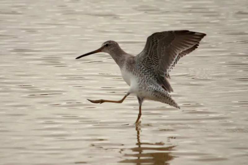
Across most of its mapped range it passes through on migration.
It is active by day. It eats mainly fish and other aquatic animals. AVONET classes it as a migrant.
The USGS habitat model maps it in 27 land-cover types, among them Unconsolidated Shore, Acadian Salt Marsh and Estuary Systems and Atlantic Coastal Plain Embayed Region Tidal Salt and Brackish Marsh.
Open-licence records from the lower 48 (3,886 of them) peak in May and are fewest in February. A typical clutch is about 4. The longest recorded lifespan is 13.3 years.
Where the Short-billed Dowitcher lives
| State | Share of state | Counties | Open records | Peak month |
|---|---|---|---|---|
| Connecticut migration | all | 9 of 9 | 42 | August |
| Rhode Island migration | all | 5 of 5 | 25 | |
| Massachusetts migration | 98% | 14 of 14 | 177 | August |
| New Jersey migration | 97% | 21 of 21 | 184 | May |
| Delaware migration | 97% | 3 of 3 | 86 | May |
| New Hampshire migration | 52% | 8 of 10 | 18 | |
| New Mexico migration | 46% | 22 of 33 | 5 | |
| Maine migration | 40% | 13 of 16 | 35 | July |
| Florida winter | 34% | 38 of 67 | 550 | March |
| Maryland migration | 33% | 9 of 24 | 39 | May |
| Colorado migration | 24% | 30 of 64 | 47 | |
| Louisiana winter | 19% | 12 of 64 | 125 | April |
| Utah migration | 18% | 8 of 29 | 7 | |
| California migration | 16% | 25 of 58 | 1,350 | April |
| Nevada migration | 14% | 9 of 17 | 13 | |
| Arizona migration | 11% | 6 of 15 | 8 | |
| Oregon migration | 10% | 11 of 36 | 86 | April |
| New York migration | 9% | 14 of 62 | 235 | August |
| South Carolina winter | 8% | 6 of 46 | 128 | May |
| North Carolina winter | 8% | 13 of 100 | 158 | May |
| Washington migration | 7% | 9 of 39 | 212 | April |
| Texas winter | 6% | 27 of 254 | 221 | March |
| Georgia winter | 4% | 8 of 159 | 29 | |
| Oklahoma migration | 4% | 2 of 77 | 21 | |
| Pennsylvania migration | 4% | 6 of 67 | 30 | |
| Virginia winter | 3% | 5 of 133 | 133 | May |
| Vermont migration | 3% | 1 of 14 | 1 | |
| Alabama winter | 2% | 2 of 67 | 24 | |
| Idaho migration | 1% | 1 of 44 | 9 | |
| Kansas migration | 1% | 3 of 105 | 27 | |
| Mississippi winter | under 1% | 3 of 82 | 43 | July |
Share of state is the part of each state inside the range map. Counties counts those with at least a tenth of their area in range. A state link opens that state's full list.
When it is recorded
Sources
- AVONET: morphological ecological and geographical data for all birds. CC BY 4.0. Read 2026-11-15.
- Amniote life-history database. CC0. Read 2026-11-15.
- EltonTraits 1.0. CC0. Read 2026-11-15.
- GBIF Backbone Taxonomy. CC BY 4.0. Read 2026-11-15.
- GBIF occurrence records under CC0 and CC BY 4.0. CC0 and CC BY 4.0 per record. Read 2026-11-15.
- Integrated Taxonomic Information System. CC0. Read 2026-11-15.
- US Census Bureau cartographic boundary files 2023. Public domain (US Census Bureau). Read 2026-11-15.
- USGS GAP 12-digit hydrologic unit range units. Public domain (USGS). Read 2026-11-15.
- USGS Gap Analysis Project Species Habitat Maps CONUS_2001 (model parameters). Public domain (USGS). Read 2026-11-15.
- USGS Gap Analysis Project Species Range Maps CONUS_2001. Public domain (USGS). Read 2026-11-15.
- iNaturalist photographs under CC0 and CC BY. CC0 and CC BY per photograph. Read 2026-11-15.
How each figure is derived is set out on the methods page.